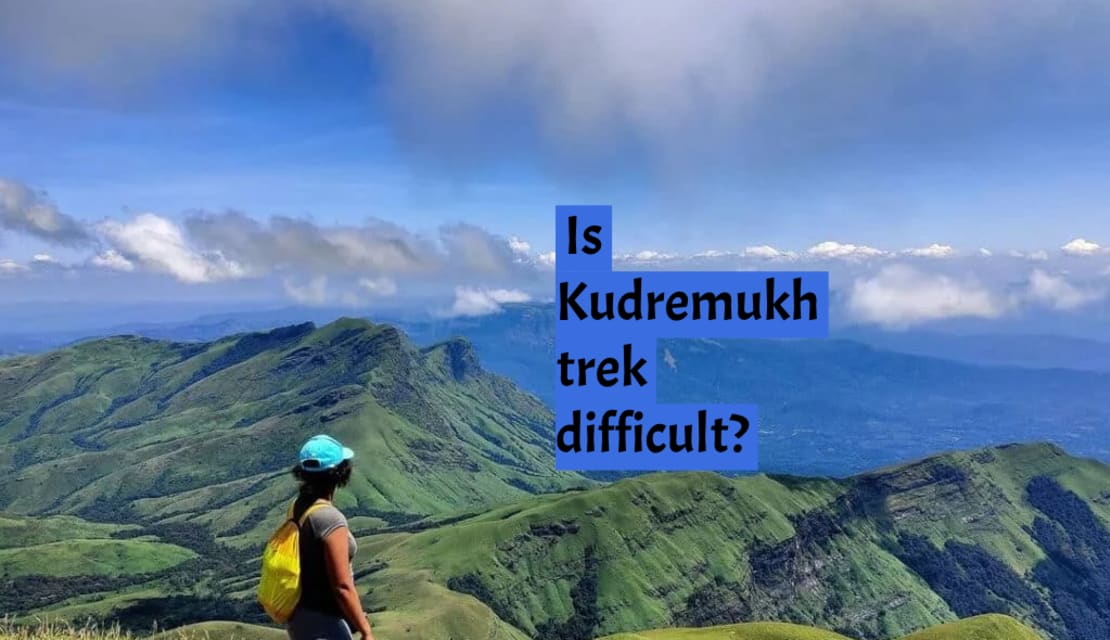
Kudremukh trek in Karnataka is worth every step to all nature lovers! Nevertheless, prior to heading into this exciting challenge, understanding the degree of complexity involved in Kudremukh trekking can be helpful. If you are a fan of nature and hiking and want to get some information regarding obstacles faced during a trek, then this is for every person who wants to know about how tough the journey is and if a person is fit enough to go through it or not. We will now dive in and find out what really makes this hiking journey so interesting?
Trail Information on the Kudremukh Trek
The Kudremukh Trek unfolds in three distinct sections:
Forest Office to Ontimara 2 (Lone Tree):
During the first phase, there is an upward path that runs through the forested areas and grassy plains. The trail will take trekkers through a natural scenic environment.
- Trek distance: 5 km
- Trek duration: 2 hours
- GPS coordinates of the forest office: 13° 9'6.61"n, 75°18'16.49"e
- GPS coordinates of the Ontimara 2: 13° 8'5.27"n, 75°17'3.87"e
Ontimara 2 to Final Stretch:
Thereafter, the path moves towards a steeper climb after Ontimara 2. As one progresses deeper into this section, the road becomes tougher, requiring higher stamina for one to continue. Trekkers should expect rock fields and rough ground.
- Trek distance: 3 km
- Trek duration: 1 hour
- GPS coordinates of the Ontimara 2: 13° 8'5.27"n, 75°17'3.87"e
- GPS coordinates of the final stretch: 13° 8'6.59"n, 75°16'22.27"e
Ridge Walk from Final Section to the Peak:
The ridge walk is also an exciting finish to the ridge that leads up to the summit. The trip comes with captive perspectives, and therefore those who succeed to get to the top are awarded by amazing landscape views.
- Trek distance: 1 km
- Trek duration: 30 minutes
- GPS coordinates for the final stretch: 13° 8'6.59"n, 75°16'22.27"e
- GPS coordinates for the Kudremukh peak: 13° 7'35.39"n, 75°16'26.06"e
The trekkers should be able to understand the unique features of each segment. In this way, they would be in a position to effectively plan for different challenges and appreciate the beauty of the diverse landscapes found along the Kudremukh Trek.
Lets Understand the Terrain and Elevation
Kudremukh trek cuts its way through different sceneries including jungles, babbling brooks and rugged mountain passes. Kudremukh is a peak that stands at a height of about 6,214 feet. The terrain is rugged, with ups and downs on the path making it rather difficult.
Moderate to Challenging Gradient
Moderate trek is in Bangalore to Kudremukh which is an easy trek for experienced hikers who are also fit. Let's break down the trek's gradient:
- Initial Phase: The climb begins gradually uphill along milder inclines with clear paths. This is one stage where trekkers can get used to the pace of the journey as they adjust.
- Steeper Sections: In addition, towards the tail of the trail the trails become quite steep necessitating endurance and strength. Expect high slopes, stones, and rough terrains that require cautious steps in advance.
Trek Duration and Distance
A hike to Kudremukh generally takes 2 to 3 days as it covers about 20 kilometers round trip depending on how fast you wish to traverse through the jungles. This may depend upon the chosen trekking route, viewing points, or when one camps en-route.
The effects of weather conditions and seasonal variation.
The trek is heavily influenced by weather conditions. The Kudremukh trek should be done during the dry seasons (October-February) when weather conditions are favorable and the trails become relatively easy to trek through. Trails in the monsoon season are slippery and tough. It involves a lot of expertise and vigilance.
Essential Preparations and Tips
For a successful and enjoyable Kudremukh trekking experience, consider the following preparations and tips:
- Physical Fitness: Do cardio, weight lift or engage in body-building for optimal body fitness.
- Trekking Gear: Buy high-quality hiking boots, comfy clothes, a waterproof backpack, a trekking pole for support, and reliable raincoat.
- Hydration and Nutrition: Pack some of the water to take along with you since there will be enough clean drinking water. Bring some small energy boosting snacks and meals with you for added energy.
- Acclimatization: Take breaks and let your body get used to the changing heights. Never go past the normal limits.
- Trekking with a Guide: One will need the services of an experienced trekking guide who comes handy especially if you are a beginner or you are unfamiliar with the place you intend to walk around in.
Conclusion:
A walk in the clouds is one of the best trek packages that involves the combination of varied sceneries, incredible viewpoints. One needs to have good physical shape for this is a relatively difficult hike. Properly planning for one as well as knowing what you will expect in terms of challenges while on your way. And then when you realize the beauty you get to see while you pass through these amazing scenic beauty, that is the most thrilling part ever.