Darjeeling | empty | Show on map
Visit Duration: 7 Hours
Timings: 9 am to 4 pm
Entry type: Free
Entry Details: empty
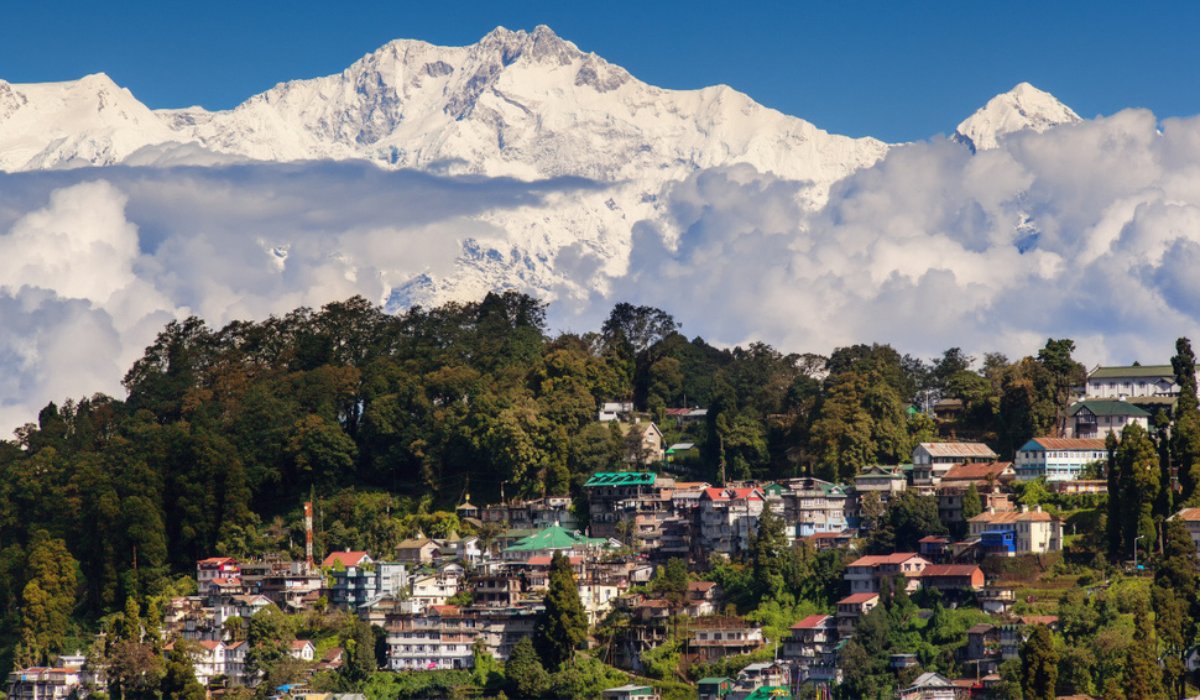
The Neora Valley National park has a spread of over 88 km. The growth of forest in Neora Valley is such that even sunlight doesn’t touch the ground. Making the park an adventurous place, much of the park is still inaccessible to the trekkers and nature lovers who can take the challenge of exploring the unknown terrain of the Kalimpong hills. To form a picturesque landscape the park has dense bamboo groves, colourful canopy of Rhododendron trees, meandering rivers and streams with snow capped mountains in the backdrop of virgin natural forests and the lush green valley. At Rachela Danda, the park reaches up to an elevation of 10600 ft. Rachela Danda is the highest point of Neora Valley National park. It borders Sikkim and Bhutan. The Neora River is the important water source of Kalimpong town.
With the backdrop of the Kangchenjunga, the Neora Valley National Park has some excellent trekking routes. Treks range from easy to moderate levels these days. An easy trek can be set off to Alubari. You can stop there and return to your base. A walk up to Rechi La can be accomplished by more experienced trekkers. Jungle safaris are conducted in a jeep on which you can go as well.
The Neora Valley National park has a spread of over 88 km. The growth of forest in Neora Valley is such that even sunlight doesn’t touch the ground. Making the park an adventurous place, much of the park is still inaccessible to the trekkers and nature lovers who can take the challenge of exploring the unknown terrain of the Kalimpong hills. To form a picturesque landscape the park has dense bamboo groves, colourful canopy of Rhododendron trees, meandering rivers and streams with snow capped mountains in the backdrop of virgin natural forests and the lush green valley. At Rachela Danda, the park reaches up to an elevation of 10600 ft. Rachela Danda is the highest point of Neora Valley National park. It borders Sikkim and Bhutan. The Neora River is the important water source of Kalimpong town.
Zero Point-Alubari
Just below the Nature Interpretation Centre, there is a bridle path that heads to the southeast which touches the slope on the Lava-Damdim Road. You drive through the oak-rhododendron-for crossing the Pankhasari Check-Post. It will take you to Zero Point Forest. Its distance is 8 kms and can be covered by a taxi. The road ends here, and you will start walking from there.
Carry with yourself a bamboo staff to make yourself more stable. Going downhill, this trail is steep at places. The Neora River is at a distance of a kilometre away. Enter an oak forest for a walk of a couple of kilometres along the water supply pipeline towards the northwest. You then arrive at a flat piece of land called Jaree-Butee. Medicinal plants are hidden amid the place which is full of wild strawberries. The name of the plants are Jaree-Butee. At a distance of about 3 km from here, is Alubari. Continuing along the mountain streams the track leads to a temperate forest. The temperate forest has long mossy growths. From large oak trees, these growths hang down.
For setting up a makeshift kitchen, an adequate cover is created by the large rocks. Near the river is the camp at Alubari. Ask the guide to show you the feeding place of an Asiatic black bear, if you decide to spend the night at the park. The feeding place of Asiatic black bear is on an oak tree. This is also popularly known as bhalu-ka-gur or the bear’s nest.
By walking back after following the trail northwards, one can reach Rechi La Top. You will be at the top after a short climb of 10 to 15-minutes. The Rechi La Top height is 3,152 m. Enjoy seeing the lights of Gangtok Valley, spending the evening on Rechi La Top. You can return early the next morning .
From Rechi La, make your way to Pankhasari exploring the Todey-Tangta route the next day. After that you can follow it up with the Pankhabari-Lava trek. There are two other options to follow however, without returning to Lava from Rechi La. You could pass through the Todey-Tangta. You can go to Chalsa further south. At a distance of about 20 km away is the roadhead in the Dooars. It takes about an hour for a walk on a motorable road. It could take half an hour by vehicle. A taxi ride is an option, if you don’t want to walk.
The Rechi La-Mouchuki-Samsung route could be taken by seasoned trekkers. Some amount of mountaineering experience is required in this route. Ropes can be useful as well as cliff-scaling skills. From Chalsa town, Samsung is at a distance of about an hour’s drive.
Receive a curated itinerary featuring the most iconic experiences in Neora Valley National Park, straight to your whatsapp.
The location was really very and the environment was also nice and the weather was also good. the stay was memorable, the food was very tasty. Highly recommended.
Sandakphu Trek Package 2024
Awesome trek and one of the best experiences to visit and we enjoyed trekking a lot. you should visit it once.
Sandakphu Trek Package 2024
I and my college friends decided to visit that place and we booked the tickets from the site of Banbanjara they give the best price and the viewpoints are really amazing. Wonderful experience.
Sandakphu Trek Package 2024
The fantastic trip and the sightseeing was also nice, the weather was also nice and the guide was friendly with us. Great recommendation.
Sandakphu Trek Package 2024
Sandakphu Trek is one of the most beautiful treks the guide was also nice to us and the viewpoints were also nice, we clicked lots of pictures at them. Wonderful trek.
Sandakphu Trek Package 2024
Overall the best experience, enjoyed lots of activities at the camo site and I will visit again soon. Wonderful experience.
Sandakphu Trek Package 2024
Best place to visit and enjoy. Highly recommended.
Sandakphu Trek Package 2024
Excellent trip and the viewpoint is awesome at the top of the mountain. Great recommended.
Sandakphu Trek Package 2024Plan your next hassle-free holiday! Send an Enquiry
Recommended
Popular Tours
Trek Of india